|
| The 1950 Ordnance Survey Map of Greenwich Town Centre (Dave Wood) |
Regular readers of this blog may remember that back in February of this year, we looked at a fascinating photograph that had been provided by Dave Wood @liverpoolimages of Enderby's Wharf, taken immediately post-war in 1946 and how we were able to compare the photograph with the LCC Bomb Damage Map as well as the same view today.
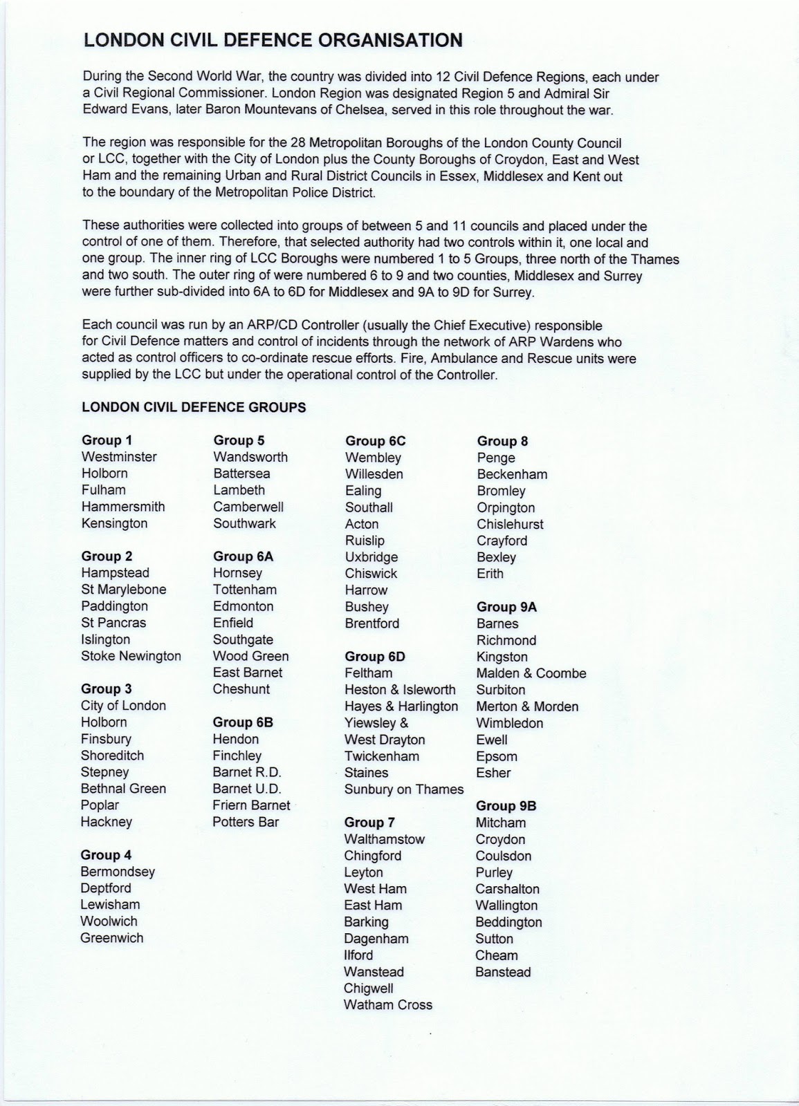
Dave has now posted another image, this time of an Ordnance Survey Map of Greenwich Town Centre dating from 1950, which regularly features the slightly enigmatic description "ruin" on the map. Given the date of the map, it is apparent that the ruins are in fact, bomb damaged buildings and following on from the Enderby Wharf exercise, it might be interesting to compare Dave's OS Map image with the ARP Incident Log, photos of the bomb damage and how it compares to the Bomb Damage Maps for the area.
 |
| Aerial view of Greenwich Town Centre immediately post-war, almost certainly taken from the Town Hall clocktower (Author's collection) |
What is just as significant as the ruins marked on the OS Map is perhaps what isn't shown; in 1950 there are large areas of emptiness in what was before the war and what is today a thriving built up area. These empty spaces are bomb sites, of which there were plenty in London in the immediate post-war years, some even surviving into the 1970s and 80s. The LCC Bomb Damage Maps for the area are held at the Greenwich Heritage Centre along with the Civil Defence Incident Logs that this author spent many hours transcribing some years ago. These resources are invaluable in translating the basic information on the Ordance Survey Maps into showing exactly which buildings were damaged and at what level of damage.
Luckily, as Greenwich has been well photographed over the years, we are able to compare the maps with photographs taken immediately after the war which graphically show the amount of damage incurred by German bombs during the Blitz of 1940-41 and subsequent V-Weapons Campaigns of 1944-45.
Therefore, if we start just below the centre of the two maps, we can see Nicholas Hawksmoor's St Alfege Church of 1718 clearly marked on the OS Map and at first glance all seems well. Compare this however with the Bomb Damage Map and we see that the church is marked in light red, signifying "Seriously Damaged, Repairable at Cost." An examination of the photograph, in which the roof of the church can be seen (unfortunately the spire is out of shot) towards the top left of the image, shows that the roof of the church is still showing signs of wartime damage, with repairs still at an early stage. The church was damaged on several occasions during the Blitz but the killer blow came on the night of 19 March 1941 when the church was gutted by Incendiary Bombs which lodged in the roof timbers, eventually causing the entire roof to plummet into the church itself where the fire burned out of control for some time. There was also an Oil Bomb reported exploding in the Churchyard on the night of 10/11 May 1941 but this seems to have done little if any damage. Happily, the church was rebuilt under the direction of Sir Albert Richardson and re-consecrated in 1953 and continues today to be an important spiritual centre of the community.
Looking at Dave's OS Map, we can see that directly opposite the church, the only building shown is a bank, in 1946 the Westminster Bank but today a Natwest branch. There is a large fallow area either side of the bank and this can be confirmed by looking at the Bomb Map, which shows many buildings coloured in black, which indicates "Total Destruction." This is interesting, because closer examination of the 1946 photograph shows that the bank building is actually still standing, although there is obvious damage both to it and to pretty much everything else left standing in the surrounding area. The cause of this almost total destruction was caused by a V-2, or as described at the time in the Incident Log, a "Long Range Rocket" which was reported at 16:19 on 24 January 1945, causing four fatal casualties, seventeen serious injuries and another ninety two walking wounded. Thanks to the excellent V2 Rocket website, we know that this missile was lauched some five minutes previously in the Den Haag area of The Netherlands. The V-2 Rockets caused widespread damage, mainly in London but also in liberated cities such as Antwerp and Brussels but which mercifully came too late to alter the outcome of the war, with the final British bound example falling at Orpington, Kent on 27 March 1945, less than six weeks before the final German surrender.
If we look again at the photograph and come slightly nearer to the camera, we can see on this side of the church The Mitre public house, which still stands today on the three-way junction with Roan Street, Straightsmouth and Greenwich High Road. Once again, there are some anomalies between the OS Map, the Bomb Damage Map and the photographic evidence, which shows the pub looking somewhat the worse for wear but probably still open for business, whilst the OS Map shows "ruins" on both sides of it. A closer look at the photograph confirms what looks like a bombed out building next door to the pub in Roan Street (which today seems to form part of the pub itself), whilst the Bomb Damage Map makes no mention of any bomb damage whatsoever at this end of Roan Street. The only bomb damage recorded in the Incident Log for Straightsmouth is a V-1 Flying Bomb further along the road, which caused severe damage to the railway embankment on 1 July 1944 and caused seven serious casualties but thankfully no fatalities. There are some further buildings marked in purple, meaning "Damaged Beyond Repair" at the junction of Straightsmouth and Roan Street but the cause of this damage is unknown as there is no mention of this in the Incident Log, although there is a corresponding fallow area on the OS Map. Despite all of this visual evidence, the bomb that caused the damage to the pub and which caused the adjacent buildings to be described as ruins, is still something of a mystery as it does not appear to have been accurately recorded. The only possible explanation is blast damage caused either by the V-2 that destroyed the area opposite St Alfege Church, or by the V-1 in Straightsmouth described above, or perhaps a combination of both.
A further look at the photograph adjacent to the tram nearer to the foreground shows some obvious bomb damage, which on the Bomb Damage Map is indeed marked in purple, as "Damaged Beyond Repair." It is hard to pinpoint exactly when this damage was caused as there were so many incidents recorded but it was probably caused on 18 September 1940 when incendiary bombs fell in the area and were reported as having destroyed number 277 and adjacent buildings on the opposite side of the road (again marked in purple on the Bomb Damage Maps), so it would seem a fair assumption. The photograph bears out the level of damage as there is a fairly large extent of cleared land on the left hand side of the road as we see it in the foreground.
On the right hand side of the photograph, to the rear of Greenwich High Road, there is almost total destruction still evident in 1946. This is almost certainly the legacy of another V-1 Flying Bomb which fell on Burney Street on 27 June 1944, causing many houses to be destroyed as well as causing widespread blast damage to the already battered area. Many of the houses were damaged beyond repair and subsequently demolished. Today, the abrupt ending of the surviving terrace gives away the location. In one of those strange post-war twists of fate, the land was later used as the site of the new Greenwich Police Station, which ironically replaced the original Police Station in Park Row, itself destroyed by a Flying Bomb in July 1944.
As a matter of interest, the nearest Air Raid Wardens' Post was 'West 5', located in the Town Hall further along Greenwich High Road, which also housed the Borough Civil Defence Control Room. The new Town Hall, completed in 1939, is an impressive Art Deco structure which with it's tall clock tower (from which the aerial photo was taken) dominates the immediate area. It houses a substantial reinforced basement, which apart from the Wardens' Post and Borough Control Room, was also the location of a large public air raid shelter, capable of housing some seven hundred people. This, together with the other public shelters in the vicinity, would have been in frequent use during most of the incidents mentioned above.
Moving further away from the camera nearer to the Thames and almost entirely out of shot behind the church, is another area shown on the Bomb Damage Map as having incurred severe damage. Unfortunately, this area is just off the top of the page for the OS Map, so we are unable to compare the two maps on this occasion but it does make interesting viewing. This area close to the entrance to the Greenwich Foot Tunnel, is shown in a combination of colours, mainly black for "Total Destruction" but with large areas of purple "Damaged Beyond Repair" and crimson "Seriously Damaged - Doubtful if Repairable" showing on the map. There is also a large area shown in green, which indicates a "Clearance Area" which in other words is an area already reduced to rubble and which has already been cleared for redevelopment. The bulk of this devastation was caused by yet another V-1 Flying Bomb that was reported at 06:24 on 3 August 1944 and which killed one person. Had the weapon fallen a few hours later, the casualties would doubtless have been higher as this was a busy area of shops and small businesses, as well as a pedestrian thoroughfare to the Foot Tunnel. Almost the whole block, including the gutted remains of the old 'Ship Hotel', which had already largely been destroyed by a HE Bomb in November 1940, was subsequently cleared to allow the building of the dry dock to house the Cutty Sark in 1954.
As always, the photographs and the two maps make fascinating reading, showing as they do an area that is familiar today to residents and visitors alike, in a completely different light. The documents also show the difficulties that sometimes arise when researching an area's wartime history and the dangers of becoming over reliant on one particular document or source of information. The LCC Bomb Damage Maps are an excellent resource and are invariably correct but one has to remember that these were produced by fallible human beings, often in the heat of the moment. What appeared beyond repair to one local authority building surveyor was sometimes actually very repairable in reality. Likewise, the Civil Defence Incident Logs were written very much in the heat of the moment and therefore sometimes get locations muddled or wrongly named. What always helps are the photographs of any bomb damaged area as these provide incontrovertible visual evidence, even though they do sometimes throw up more questions!
However, the use of all of these sources together will usually allow the determined researcher to get to the bottom of most mysteries as well as providing hours of harmless fun in the process!
As this is likely to be the final blog post for 2016, I'd like to thank everyone for reading and commenting upon the various articles, as well as wishing all of our readers the compliments of the season and also a happy and healthy 2017. We will be back in January with further reports on our wartime history.
Unpublished Sources:
LCC Bomb Damage Maps for Greenwich - held at Greenwich Heritage Centre
Metropolitan Borough of Greenwich Civil Defence Incident Logs - held at Greenwich Heritage Centre
Metropolitan Borough of Greenwich Public Air Raid Shelter locations - held at Greenwich Heritage Centre
Metropolitan Borough of Greenwich Air Raid Wardens' Post locations - held at Greenwich Heritage Centre
 |
| Greenwich Town Centre Bomb Map (Author's image from original at Greenwich Heritage Centre) |
Therefore, if we start just below the centre of the two maps, we can see Nicholas Hawksmoor's St Alfege Church of 1718 clearly marked on the OS Map and at first glance all seems well. Compare this however with the Bomb Damage Map and we see that the church is marked in light red, signifying "Seriously Damaged, Repairable at Cost." An examination of the photograph, in which the roof of the church can be seen (unfortunately the spire is out of shot) towards the top left of the image, shows that the roof of the church is still showing signs of wartime damage, with repairs still at an early stage. The church was damaged on several occasions during the Blitz but the killer blow came on the night of 19 March 1941 when the church was gutted by Incendiary Bombs which lodged in the roof timbers, eventually causing the entire roof to plummet into the church itself where the fire burned out of control for some time. There was also an Oil Bomb reported exploding in the Churchyard on the night of 10/11 May 1941 but this seems to have done little if any damage. Happily, the church was rebuilt under the direction of Sir Albert Richardson and re-consecrated in 1953 and continues today to be an important spiritual centre of the community.
Looking at Dave's OS Map, we can see that directly opposite the church, the only building shown is a bank, in 1946 the Westminster Bank but today a Natwest branch. There is a large fallow area either side of the bank and this can be confirmed by looking at the Bomb Map, which shows many buildings coloured in black, which indicates "Total Destruction." This is interesting, because closer examination of the 1946 photograph shows that the bank building is actually still standing, although there is obvious damage both to it and to pretty much everything else left standing in the surrounding area. The cause of this almost total destruction was caused by a V-2, or as described at the time in the Incident Log, a "Long Range Rocket" which was reported at 16:19 on 24 January 1945, causing four fatal casualties, seventeen serious injuries and another ninety two walking wounded. Thanks to the excellent V2 Rocket website, we know that this missile was lauched some five minutes previously in the Den Haag area of The Netherlands. The V-2 Rockets caused widespread damage, mainly in London but also in liberated cities such as Antwerp and Brussels but which mercifully came too late to alter the outcome of the war, with the final British bound example falling at Orpington, Kent on 27 March 1945, less than six weeks before the final German surrender.
If we look again at the photograph and come slightly nearer to the camera, we can see on this side of the church The Mitre public house, which still stands today on the three-way junction with Roan Street, Straightsmouth and Greenwich High Road. Once again, there are some anomalies between the OS Map, the Bomb Damage Map and the photographic evidence, which shows the pub looking somewhat the worse for wear but probably still open for business, whilst the OS Map shows "ruins" on both sides of it. A closer look at the photograph confirms what looks like a bombed out building next door to the pub in Roan Street (which today seems to form part of the pub itself), whilst the Bomb Damage Map makes no mention of any bomb damage whatsoever at this end of Roan Street. The only bomb damage recorded in the Incident Log for Straightsmouth is a V-1 Flying Bomb further along the road, which caused severe damage to the railway embankment on 1 July 1944 and caused seven serious casualties but thankfully no fatalities. There are some further buildings marked in purple, meaning "Damaged Beyond Repair" at the junction of Straightsmouth and Roan Street but the cause of this damage is unknown as there is no mention of this in the Incident Log, although there is a corresponding fallow area on the OS Map. Despite all of this visual evidence, the bomb that caused the damage to the pub and which caused the adjacent buildings to be described as ruins, is still something of a mystery as it does not appear to have been accurately recorded. The only possible explanation is blast damage caused either by the V-2 that destroyed the area opposite St Alfege Church, or by the V-1 in Straightsmouth described above, or perhaps a combination of both.
 |
| The clearing up operation after the V-1 of 1 July 1944 (Greenwich Heritage Centre) |
A further look at the photograph adjacent to the tram nearer to the foreground shows some obvious bomb damage, which on the Bomb Damage Map is indeed marked in purple, as "Damaged Beyond Repair." It is hard to pinpoint exactly when this damage was caused as there were so many incidents recorded but it was probably caused on 18 September 1940 when incendiary bombs fell in the area and were reported as having destroyed number 277 and adjacent buildings on the opposite side of the road (again marked in purple on the Bomb Damage Maps), so it would seem a fair assumption. The photograph bears out the level of damage as there is a fairly large extent of cleared land on the left hand side of the road as we see it in the foreground.
On the right hand side of the photograph, to the rear of Greenwich High Road, there is almost total destruction still evident in 1946. This is almost certainly the legacy of another V-1 Flying Bomb which fell on Burney Street on 27 June 1944, causing many houses to be destroyed as well as causing widespread blast damage to the already battered area. Many of the houses were damaged beyond repair and subsequently demolished. Today, the abrupt ending of the surviving terrace gives away the location. In one of those strange post-war twists of fate, the land was later used as the site of the new Greenwich Police Station, which ironically replaced the original Police Station in Park Row, itself destroyed by a Flying Bomb in July 1944.
 | ||
| Damage to Burney Street after the V-1 incident of 27 June 1944 (Greenwich Heritage Centre) |
As a matter of interest, the nearest Air Raid Wardens' Post was 'West 5', located in the Town Hall further along Greenwich High Road, which also housed the Borough Civil Defence Control Room. The new Town Hall, completed in 1939, is an impressive Art Deco structure which with it's tall clock tower (from which the aerial photo was taken) dominates the immediate area. It houses a substantial reinforced basement, which apart from the Wardens' Post and Borough Control Room, was also the location of a large public air raid shelter, capable of housing some seven hundred people. This, together with the other public shelters in the vicinity, would have been in frequent use during most of the incidents mentioned above.
Moving further away from the camera nearer to the Thames and almost entirely out of shot behind the church, is another area shown on the Bomb Damage Map as having incurred severe damage. Unfortunately, this area is just off the top of the page for the OS Map, so we are unable to compare the two maps on this occasion but it does make interesting viewing. This area close to the entrance to the Greenwich Foot Tunnel, is shown in a combination of colours, mainly black for "Total Destruction" but with large areas of purple "Damaged Beyond Repair" and crimson "Seriously Damaged - Doubtful if Repairable" showing on the map. There is also a large area shown in green, which indicates a "Clearance Area" which in other words is an area already reduced to rubble and which has already been cleared for redevelopment. The bulk of this devastation was caused by yet another V-1 Flying Bomb that was reported at 06:24 on 3 August 1944 and which killed one person. Had the weapon fallen a few hours later, the casualties would doubtless have been higher as this was a busy area of shops and small businesses, as well as a pedestrian thoroughfare to the Foot Tunnel. Almost the whole block, including the gutted remains of the old 'Ship Hotel', which had already largely been destroyed by a HE Bomb in November 1940, was subsequently cleared to allow the building of the dry dock to house the Cutty Sark in 1954.
As always, the photographs and the two maps make fascinating reading, showing as they do an area that is familiar today to residents and visitors alike, in a completely different light. The documents also show the difficulties that sometimes arise when researching an area's wartime history and the dangers of becoming over reliant on one particular document or source of information. The LCC Bomb Damage Maps are an excellent resource and are invariably correct but one has to remember that these were produced by fallible human beings, often in the heat of the moment. What appeared beyond repair to one local authority building surveyor was sometimes actually very repairable in reality. Likewise, the Civil Defence Incident Logs were written very much in the heat of the moment and therefore sometimes get locations muddled or wrongly named. What always helps are the photographs of any bomb damaged area as these provide incontrovertible visual evidence, even though they do sometimes throw up more questions!
However, the use of all of these sources together will usually allow the determined researcher to get to the bottom of most mysteries as well as providing hours of harmless fun in the process!
As this is likely to be the final blog post for 2016, I'd like to thank everyone for reading and commenting upon the various articles, as well as wishing all of our readers the compliments of the season and also a happy and healthy 2017. We will be back in January with further reports on our wartime history.
Unpublished Sources:
LCC Bomb Damage Maps for Greenwich - held at Greenwich Heritage Centre
Metropolitan Borough of Greenwich Civil Defence Incident Logs - held at Greenwich Heritage Centre
Metropolitan Borough of Greenwich Public Air Raid Shelter locations - held at Greenwich Heritage Centre
Metropolitan Borough of Greenwich Air Raid Wardens' Post locations - held at Greenwich Heritage Centre